The GIS Starter Series, Part 1: What to Build First (and Who It Helps)
A practical checklist of maps and apps that get real traction in city departments.
When you’re starting a GIS program from scratch — or maybe using GIS in just one department — a big part of the job is convincing others it’s worth investing in.
You can see all the glorious ways GIS could benefit your agency. But how do you get them to buy in?
With every city set up a little differently — different departments, different budgets, different levels of tech-savviness — there’s no one-size-fits-all strategy. But here are some ideas I’ve seen work across multiple local governments.
These are real examples of maps, apps, and data I’ve helped develop that turned skeptics into champions. In future posts, I’ll show you how to build some of these. While Esri provides a ton of templates and solutions, it can get a little overwhelming when you’re just getting started. Think of this as a starter checklist — a jump-off point for what GIS can do across your organization.
I’ve also included a few example apps from other agencies to help illustrate what these ideas look like in the real world. Sometimes, seeing how another city solved a problem is all it takes to spark internal buy-in.
Note: If you can find one champion in your organization — or better yet, in each department — it makes all the difference.
By creating more web-accessible GIS tools, the goal is to:
Reduce calls and email requests to City staff
Free up time for deeper work
Keep both staff and the public better informed
Agency-wide
Agency-wide Hub
Hubs are relatively easy to set up and serve as a one-stop shop for all GIS in your agency.
Base Map Viewer
Parcel lookup, land use, zoning, transportation, city limits — all in one place.
(Or break it into separate zoning and land use apps.)Report-a-Problem App
Let residents report potholes, graffiti, or damaged signs.
This can be integrated with a Work Order Management System (e.g., Lucity, CityWorks, or Tyler).
Public Works
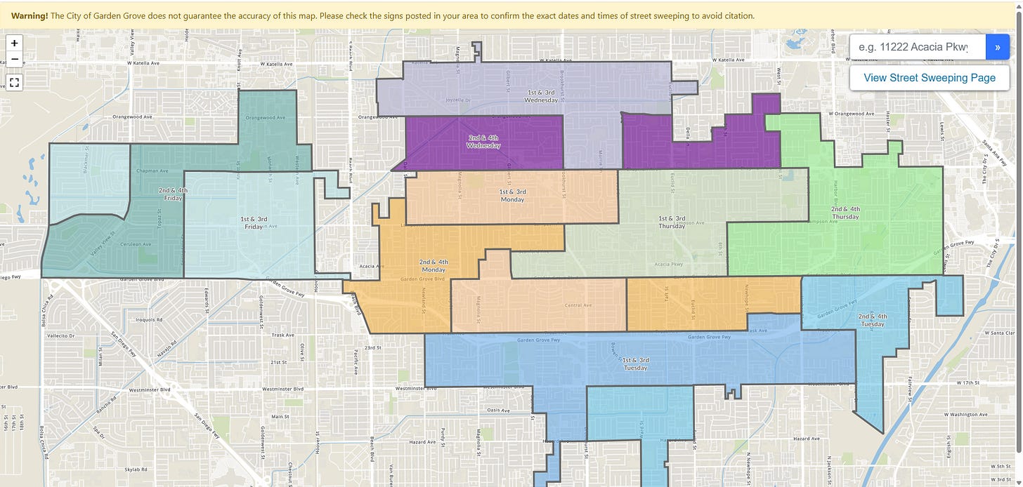
Street Sweeping Map
Helps residents understand when to move their cars and reduces complaints.
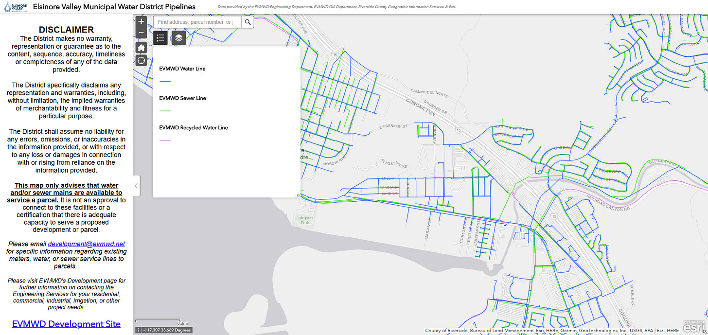
Utility Viewer
Internal or public-facing map of stormwater, sewer, and water utilities.
Utility Outage/Shutoff Dashboard
Water and Sewage utility outages.
Parks & Recreation
Trail Maps
Offer printable PDFs or a mobile-friendly trail web app.Park Facility Viewer
Map of amenities, with pop-ups that link to rental info, hours, or forms.
Fire
Fire Service Maps (Digital or Print)
District maps with addresses, hydrants, access roads, and building footprints.Hydrant Inspection App
For tracking inspections and maintenance, especially in the field.
Planning
Zoning Lookup App
Future/Existing Land Use Layers
Neighborhood and HOA Viewer
Citizen Notification Tool (to generate mailing labels and buffers)
Historic Buildings StoryMap
Annexation Viewer
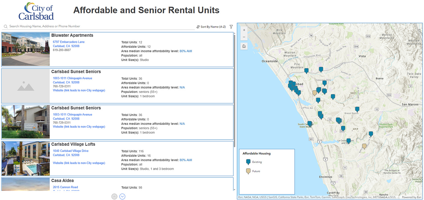
Affordable Housing Inventory Map
Emergency Services
Large Format Base Maps for EOC Use
Paper maps are often quickest in emergency operations.External GIS Backup
Offline backup of your full GIS dataset in case of outages.Floodplain/FIRM Map App
Engineering
Survey Control Viewer
Includes monument data and documentation.Capital Improvement Projects (CIP) App or Dashboard
Helps staff and citizens see the status of projects across the city.Bikeway Network Map
Administrative Services
Voting District or Council District Map
Building & Permitting
Permit Viewer
Map permits spatially — optionally integrated with your permitting platform.
Finance
Tax District Viewer
Police
Crime Mapping Tool
Can be internal-only or public, depending on the use case.
What’s Next?
Start with 1–2 departments that regularly receive questions or calls that could be handled with a simple map or dashboard. Build something useful, get feedback, then build on it.
In the next few posts, I’ll show how to:
Organize your ArcGIS Online content and folders
Create ArcGIS Pro templates
Build shareable dashboards and apps from scratch
Please subscribe and send me a message if you have a suggested topic! I’d love to explore your ideas!


